
Features Chuyển Tọa Độ VN2000
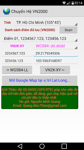
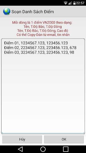
The purpose applications:- Find location of the plot on Google Maps when drawing location coordinates (in system VN2000)- Used in the field of measurement: finding moldy, musty position to score, calculate the coordinates of the reference value.Applications used to convert two-dimensional XY coordinates in Lat-Long Contacts VN2000 to WGS84.- Coordinates XY in VN2000 system is used in the formal drawings as diagrams, housing certificates, technical drawings.- Coordinates Lat-Long used as the international standard of Google Maps.
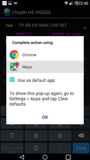
Therefore to locate one point in drawing LUC on the map Google Maps satellite images, we need to convert it to value Lat-Long WGS84 and sent to the Google Maps app.* The program is completely free, no advertising inserts.
Secure & Private
Your data is protected with industry-leading security protocols.
24/7 Support
Our dedicated support team is always ready to help you.
Personalization
Customize the app to match your preferences and workflow.
See the Chuyển Tọa Độ VN2000 in Action
Get the App Today
Available for Android 8.0 and above